
| F |
For a while it seems like we might have to delay for a day - we were at the studio til midnight last night photographing Cheryl's newest paintings for the gallery, and a sudden nasty bug appeared this morning in my major client's software - but all these things are resolved and just after 1400 we untie the lines and are off.
We've planned a quick stop at the fuel dock, and then motor out for Noel and Joan to get the 'Departure Photo', but we suffer our first breakdown of the trip when I try to switch the holding tank valve from pumpout mode to macerator mode, and the handle snaps without moving the valve. We finally get under way just after 1500, and, amazingly, Noel and Joan are still waiting at the point. I'm sure she enjoyed the messages on her cel phone when they got back to the car.
The first afternoon we travel through cloudy skies, then rain, then a gusty wind switch from NW to SE, including a weather warning for Merry Island for gusts to 30 knots and rough seas given 20 minutes before we were there.
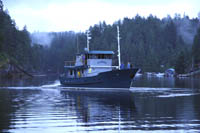 Fortunately we missed most of that squall and ended up motoring into Secret Cove
Our second day, June 22, we travel from Secret Cove to Squirrel Cove
Traveling north on the BC Coast takes you through a series of gateways - Cheryl thinks of them like the C.S. Lewis wardrobe door - for me they're more like Huxley's Doors of Perception - they're natural barriers, each of which requires more preparation, more self-reliance and more independence than the last. Many boaters never leave the bountiful cruising grounds of Georgia Strait and Desolation Sound.
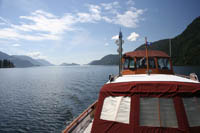 The tidal rapids of Seymour Narrows and the Yucultas make the first gateway. Getting around Cape Caution at the northern end of Vancouver Island is the second. When I fished here in the 1980s there were very few pleasure boats north of Cape Caution. The third gateway is getting to Haida Gwaii, either across Hecate Strait, the route we will take, or across Queen Charlotte Sound, a route used by many cruising sailboats.
We're running out of time to post this tonight (June 25), so here's the abbreviated version of the next 3 days. On the 23rd we noticed a vibration in the starboard shaft, but deemed it ok to travel, so we headed north from Squirrel through the first set of rapids (Yucultas, Gillard Passage and Dent Rapids) at low slack, then to Shoal Bay
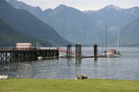 We decided to leave early the next morning to catch the high slack at Greene Point
and ride the big ebb up Johnstone Strait with an eye toward hauling the boat out at Alert Bay
or Sointula.
The winds were calm in Johnstone Strait, so we took advantage of the big ebb and went all the way to Growler Cove
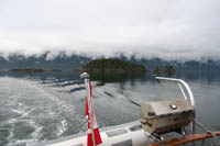 just across from Robson Bight, before stopping to cook some food and have a bit of a rest. Leaving there, we reached Tarkanen Marine Ways
This morning (June 25) at low tide,
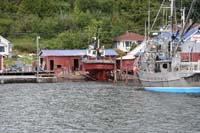 we could see that the underwater structure was all fine. The problem appears to be in the reduction gear, and that's going to be hard to fix during the trip. The question for us now is can we continue the trip by taking the stess off of the starboard transmission (reduction gear) by running that side slower, upping the speed on the port side to compensate.
Off the ways on the afternoon tide June 25, then over to Port McNeill
Later that night we discovered our macerator pump motor was completely shorted out - the one pump I didn't have a complete spare for.
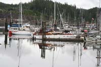 Sunday morning June 26 we searched Port McNeill, but the only marine store didn't open Sundays, and it looked doubtful for having the pump. I phoned Port
Hardy
Sunday morning June 26 we searched Port McNeill, but the only marine store didn't open Sundays, and it looked doubtful for having the pump. I phoned Port
HardyWalker Group Anchorage is wild and beautiful with entrances to both east and west. A lone sailboat, the 'Surf Scoter' out of Sidney, B.C. was there when we arrived, and it looked like the two old wooden boats would have a quiet anchorage to ourselves.
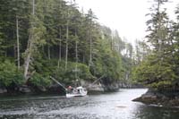 Then just at dusk the old fishboat 'Sharon S' came in, dropped anchor about 100 feet away and we realized they had a live tank hold with a very noisy generator/pump affair that was going to run all night. Oh well, these are tough times for many B.C. fishermen, we can handle some noise. Next day the forecast was dicey for going around Cape Caution, so we tried out our fishing gear. In about 10 minutes we had a salmon on, but couldn't land it - and then couldn't find another.
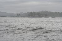
Tuesday June 28, forecast was for NW 10-15 dropping to light, West Sea Otter buoy was reporting 1.4 metre combined sea and swell height, so off we went for Cape Caution, keeping the anchorage at Miles Inlet close at hand in case things got ugly. The swells were large, but with no wind the sea was glassy and we pressed on for a pretty comfortable first passage around the dreaded Cape for Sovereign and Cheryl. We're through the first gateway.
Next Chapter